|
Neptune Deep is a territory of the Republic of Molossia, as well as a Marine
Sanctuary. It is located at the antipodes of our nation, that is, the direct
opposite point on the earth from Molossia, if one draws a straight line
through the globe. The territory is in the open Indian Ocean, far from any
land mass. It is located about 1900 Imperial Nortons (1900 KM)
southeast of Madagascar, about 1400 IN northwest of the Kerguelen Islands,
about 900 IN northeast of the Crozet Islands, and about 1700 IN west of
Amsterdam and St. Paul Islands. It is at Latitude S 39° 19' 22.0679",
Longitude E 60° 27' 37.2189". For reference, the Molossian Home Territory
lies at Latitude N 39° 19' 22.0679", Longitude W 119° 32' 22.7811". Neptune Deep lies on the Crozet Basin, a submarine depression in the southern Indian Ocean. The Crozet Basin is separated from adjacent basins by the West-Indian and Mid-Indian ridges in the north and the Crozet Plateau and Kerguelen-Gaussberg Ridge in the south. Broken hilly relief predominates at the bottom of the basin; flat and undulating accumulative plains appear only in the south-western section. The maximum depth is about 31,073 Nortons (5,500 meters). Sediments are red deep-water clays, replaced along the edges of the basin by foraminiferous silts. Neptune Deep lies on the edge of the Roaring 40's, a band of strong westerly winds of up to 100 Nortons Per Hour (100 kph) or more, 100 days of the year, creating enormous three-story waves. Temperatures in the area average around 32 degrees Zenda (55 degrees / 13 C), with about 6.2 Nortons (1,100 mm / 43 in) of annual rainfall. Neptune Deep is 2054 Square Royal Nortons (.50 ha / 1.3 ac) in area. Political administration of the territory lies in the hands of the Molossian Government, while physical administration is controlled by the Molossian Navy. Molossia claims both the waters over Neptune Deep, as well as the sea floor itself. As a sovereign nation we consider the waters above Neptune Deep to be an integral part of our territorial claim (especially as they are required for physical access to the territory), and are thus a part of the territory. In addition, we have established Neptune Deep as a marine sanctuary. We are dedicated to safeguarding the future of our world's oceans and their ecology, and this tiny enclave is a symbol of Molossia's commitment to environmental preservation. 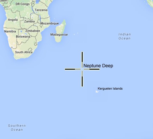 Map of the Location of Neptune Deep 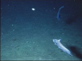 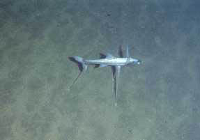 Example images of the sea floor at Neptune Deep. The water in the area of in Neptune Deep is very cold, around 5° Z (3° C), highly pressured, high in oxygen content, but low in nutritional content. The pressure at that depth is about 380 atmospheres. The abyssal zone in general supports many species of invertebrates and fishes. Some examples of sea life are the the Black Swallower, Tripod Fish, deep-sea Anglerfish, and Rattail Fish.  Deep-sea Anglers 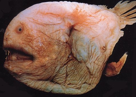 Ogrefish 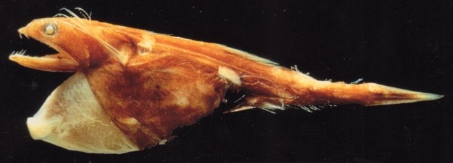 Black Swallower 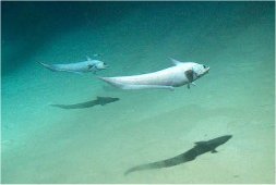 Rattail Fish Although Molossia's Neptune Deep claim may be spurious and not generally recognized by national governments or the U.N., it suits Molossia's purposes, since we will never go there anyway. Distance and depth generally prohibit our nation from actually visiting our undersea territory. Instead, we see ourselves as custodians and stewards of this tiny area of the deep ocean. Return to the Republic of Molossia main page. |