Molossian Institute of Volcanology
MONO CRATERS VOLCANIC FIELD
California


Geologic Background of Mono Craters

The history and deposits of the Mono Craters volcanic field overlaps with that of the Long Valley caldera and the Inyo Craters volcanic field. The Mono-Inyo Craters volcanic field developed along a 50 kilometer (30 mile) long fissure system that extends northward from Mammoth Mountain on the southwestern rim of the caldera to Mono Lake. Rhyolitic volcanism began on the Mono Craters chain northwest of the caldera about 35,000 years ago. Mono Craters consists of a chain of at least 30 coalesced domes, flows, and craters. The youngest feature is only 600 years old. Eruptions at the Mono-Inyo Craters volcanic field occurred at 500-year intervals over the past 2,000-3,000 years. The most recent eruption in the region was at Mono Lake between 1720 and 1850 A.D. A dome grew on the lake floor and emerged to make Paoha Island.

The Mono Craters for the most part have followed three eruptive phases.

The first phase is characterized by an explosion caused by the release of gas trapped within the magma under high pressure. This leaves an explosion crater with a prominent debris ring. Much of the magma volume is erupted during this phase and blasted into the air as ash. The smooth grey slopes of the Mono Craters are from a thick mantling of this ash also called tephra.

The second phase of eruptions involve the extrusion of lava. This extruded lava is extremely thick and viscous and rises to the surface in an almost solid form. The lava builds a steep dome within the explosion crater sealing the vent or fissure source. Most of the gas from this lava was released during the first phase so explosions are smaller and less frequent. Panum Crater is a textbook example of what occurs during the second phase of eruptions.


The most recent activity at the Mono Craters has been at the north and south extremities of the range. The last known eruption occurred when Panum Crater was formed some 630 years ago. This age comes from trees dated to 1369 AD found growing upon deposits from that eruption.

Panum Crater

Panum Crater is a classic example of an explosion pit in which the subsequent lava plug was not large enough to completely fill the initial tephra ring. The tephra ring, which has a diameter of 1200 meters (4000 feet) consists of pumice ash and lapilli, obsidian fragments and "accidental" ejecta (granite pebbles).

The rhyolite dome consists of light gray, pumiceous rhyolite and rhyolite breccia comprised of angular, pebble and cobble-sized fragments of rhyolite. Most of the rhyolite is flow banded with bands dipping steeply away from the dome summit.

Panum Crater formed in a sequence of events. The first event was caused by magma rising from depth. When the magma made contact with water just below the surface, the water expanded into steam and a violent eruption occurred. The blast created a gaping crater. Following the initial phreatic blast, a fountain of cinders shot up a great distance into the air. As this ash and pumice fell back to the earth, it formed a pumice ring, around the original crater.

Following the violent eruptions of the first two phases, the remainder of the thick magma slowly rose to the surface to form a series of domes. Each dome began with an outpouring of the viscous, rhyolitic lava, which hardened and formed a cap over the vent. As magma continued to push up, the cap (or dome) shattered and fell to the outside of the newly formed dome. This created a mountain of these broken pieces, called crumble breccia.

As the final dome hardened, a period of spire building commenced. Thick lava squeezed up through cracks in the dome and formed castle-like spires. If you can imagine toothpaste squeezing through the opening of a tube and forming a small tower before it topples over, you can imagine how these spires form. Most of the spires at Panum collapsed and broke. The debris you see at the top of the dome is the remains of spires that have crumbled.

From Highway 395, take Highway 120 approximately 4.8 kilometers (3 miles) east to a signed (Panum Crater) washboard dirt road that heads north toward the crater. Take this road about 1.6 kilometers (1 mile) to a parking area and interpretive sign at the base of the crater. Follow the trail to the crest of the pumice-covered rim and from there to the jumbled rocks of the lava dome.


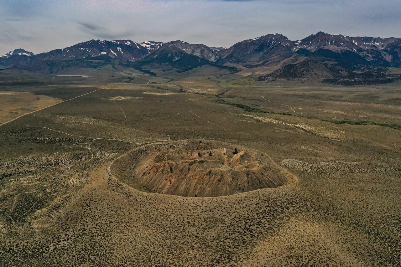
Panum Crater from the air.

Panum Crater.

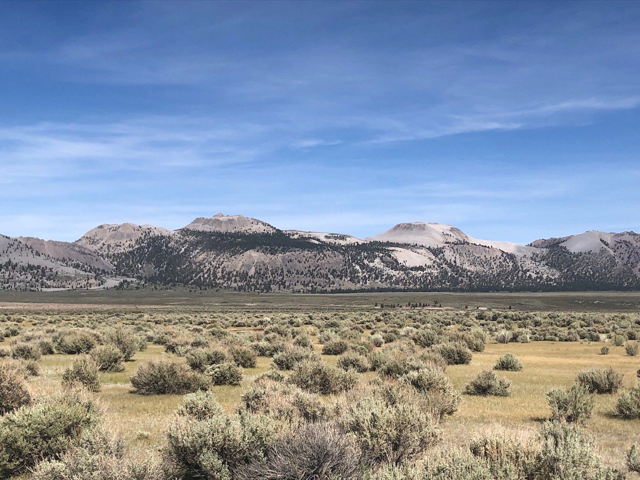
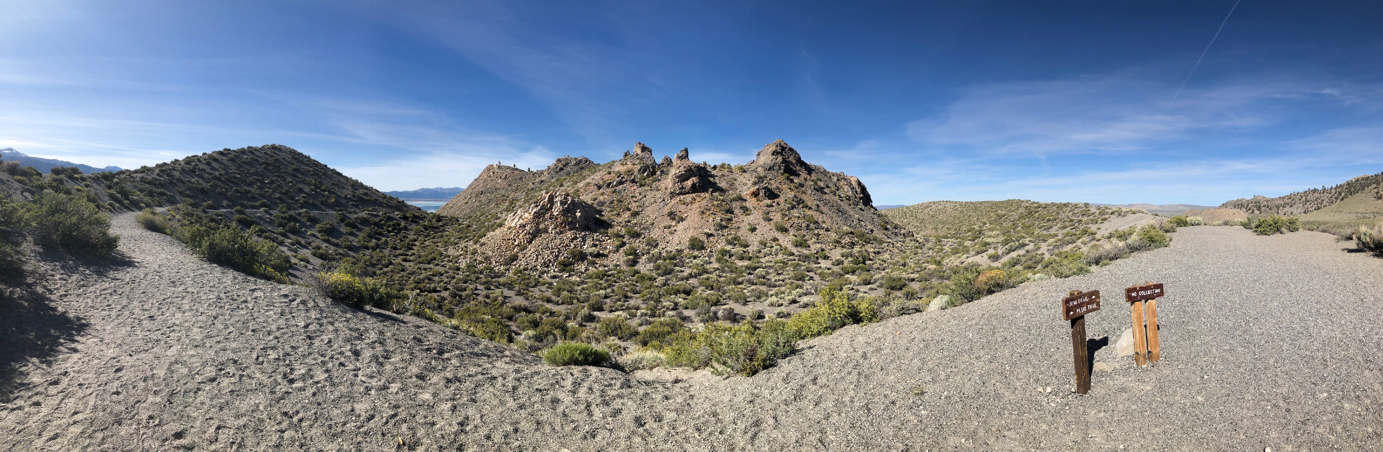
Panorama from the crater rim.

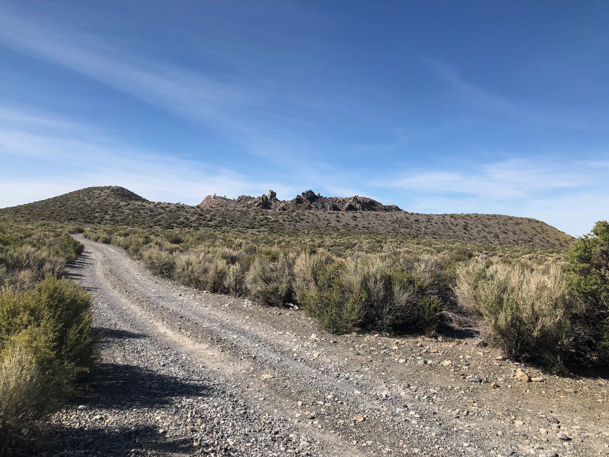
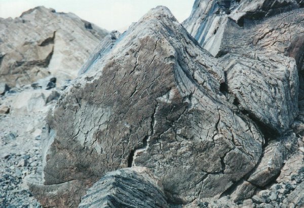
Rhyolitic lava formation inside the lava dome.

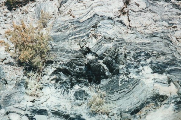
Obsidian formation inside the lava dome.
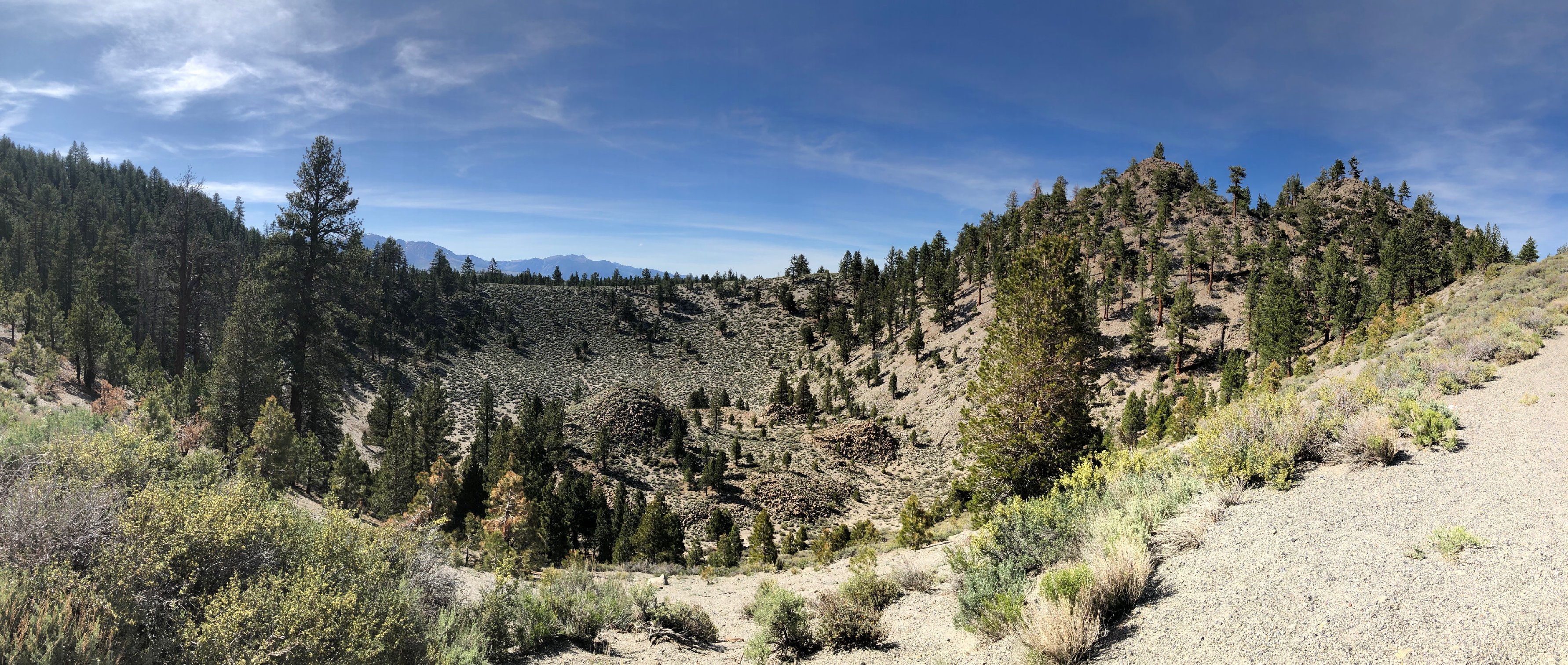
Devil's Punchbowl

Devil's Punchbowl is an example of a smaller explosion pit. It is in the Mono Basin, located at the south end of the Mono Craters.

From Highway 395, turn off at Pumice Mine Road, near June Lake Junction and about 22 kilometers (14 miles) north of the Mammoth Lakes exit. Travel about 4.8 kilometers (3 miles) on Pumice Mine Road, staying left. The crater is on the left (north) side of the road.


Devil's Punchbowl.


Return to the Molossian Institute of Volcanology Main Page.